Please see the link below for The Compliance update to the Comprehensive Plan it includes adding a Private Property Rights element
Zoning Districts
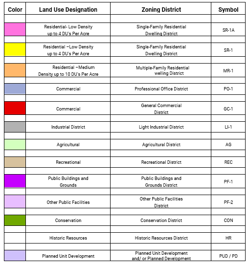
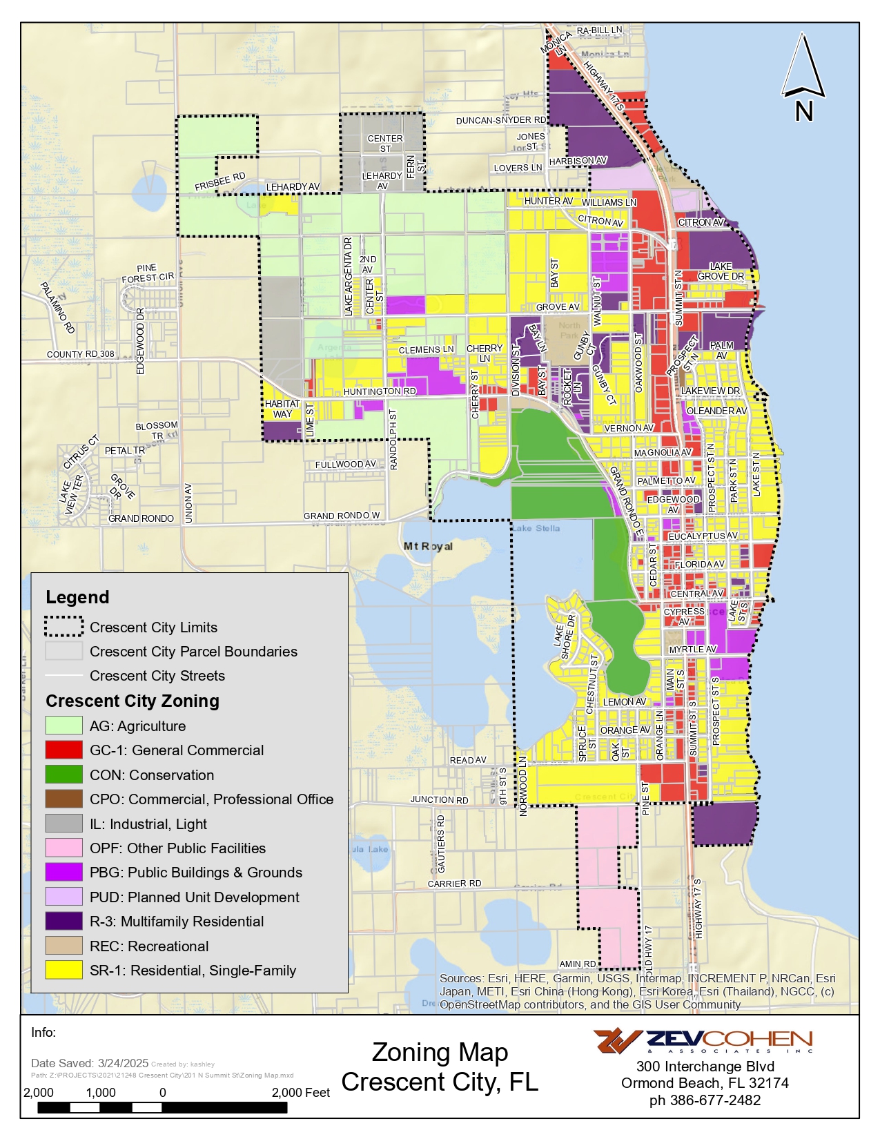
In order to classify, regulate and restrict the uses of land, water, buildings and structures; to regulate and restrict the height and bulk of buildings; to regulate the area of yards and other spaces around buildings; and to regulate the intensity of land use, the City of Crescent City is divided into the following zoning districts:

To use interactive G.I.S. map developed by Putnam County's G.I.S. Department enter here.
Disclaimer:
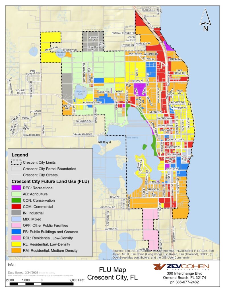
The maps are for reference only. The data provided is derived from multiple sources with varying levels of accuracy. Putnam County, the City of Crescent City, and its employees disclaim all responsibility for the accuracy or completeness of the data shown.


